


Arab Spatial: Development and Food Security Information Tool
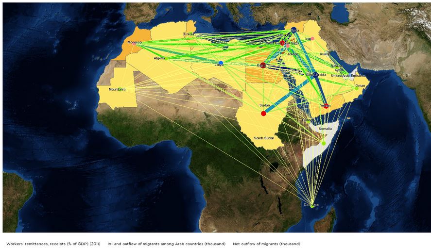
Arab Spatial, originally launched in 2013, now features an upgraded version and three country-level tools: Iraq Spatial, Yemen Spatial, and Palestine Spatial. The tool compiles, synthesises, and geographically displays data on more than 200 indicators of food security and development. In order to capture reliable data in the rapidly changing Middle East and North Africa (MENA) region, this interactive mapping tool analyses displays data on food availability, accessibility, stability, and utilisation, and the resulting nutritional status of individuals, and allows users to customise maps and charts according to their needs. These dimensions of food security are related to: the macro-economy; developments in key sectors and governance; population, access to services, poverty, nutrition, and disease; and external shocks and interventions.
The upgraded tool now includes:
- a gallery of downloadable pre-made graphs on Arab nations’ development and food security;
- customised analytical tools that allow users to compare and explore data by indicators, regions, and year, and to download the results;
- multilayer maps;
- simpler navigation and greater interactivity; and
- Iraq Spatial, which provides over 200 indicators, including macroeconomic, sectoral, climate, biophysical, and socioeconomic data at the national, subnational, and pixel level.
For example, a map may show yield gaps, regions with and without irrigation, routes for remittance and their relative importance in food security, trade infrastructure, economic growth, and resilience and conflict relationships.
Maps can be created for the locations of food security projects and the numbers of projects for each location. These may be overlaid by locations of projects from other organisations to see concentrations. The maps will show total food aid in kilograms and areas of distribution, as well as locations of anti-corruption projects associated with aid.
The data may be used to inform current projects, review past projects, and plan or advocate in the short- and long-term for future projects.
A PDF format document on The Food Security System: A New Conceptual Framework is also available through Arab Spatial.
Arabic and English
Emails from Marcia MacNeil to The Communication Initiative on January 16 2014, March 27 2014, September 5 2014, and April 29 2015.
- Log in to post comments